8-10-04 Bend, Oregon to Fall River Mills, California The aircraft dealer at the Bend Airport turned out to be a Lancair builder, so I didn’t follow through. My father may have had the wrong town in Oregon. I wandered around trying to get out of Bend. Bend has circular intersections (traffic wheels?). I became confused and went north instead of south. I had to turn into another series of circles to head back the right way. The Cascade Lakes Highway/ Cascade Scenic Byway scenic route wasn't, but it beat riding with the traffic on the 97. I did not get the views I’d hoped for. There was one good overlook of the South Sister (of the Three Sisters volcanoes), but no pullout. I stopped at the Mt. Bachelor ski area hoping for ride to the top, so I could claim the mountain the easy way. The lifts didn’t open until 11 AM. I went back to the road. The scenic byway rejoined the 97, which was still a 55 mph road. I bumped my speed up to 65 mph to avoid being flattened from behind. After 100 miles on Cascade Scenic Byway and 60 miles on 97, I looked for a lunch spot. There was an Indian Casino in the middle of the woods, offering a buffet. The Kla-Moya Casino was small. The buffet, $8.00. There was a limited selection of good food. It was not crowded, with twenty or thirty people repetitively punching slot machines.A short time later, I crossed the California border and reached the perimeter of the Lava Beds National Monument. The beds were deposited through the actions of one large volcano, according to the ranger at the field station. The lava fields overlaid a large caldera. She gave me directions for a couple of good motorcycle roads into and out of the monument. It took a few false turns, but I eventually arrived at the heart of the monument. The ranger told me that the only external sign of volcanic activity in the park was a hole in the ground, labeled on some maps as “Hot Spot”. Supposedly, hot dogs can be cooked in the heat emanating from the hole. |
I drove to a trail leading to a lookout on top of a cinder cone, Schonchin Butte. Dropping off my riding gear, I hiked up the trail through the heat to the top in about a half-hour. The building at the top turned out to be both a view station and a fire observatory. There was a fire spotter stationed in the building. The building had a bed, a work table with a map and sextant, a stool at the table, and a map on the wall. The spotter explained that if he saw smoke, he plotted the radius on the map and radioed it in. An adjacent fire station cross-referenced his plot with their plot to fix the location of the fire. 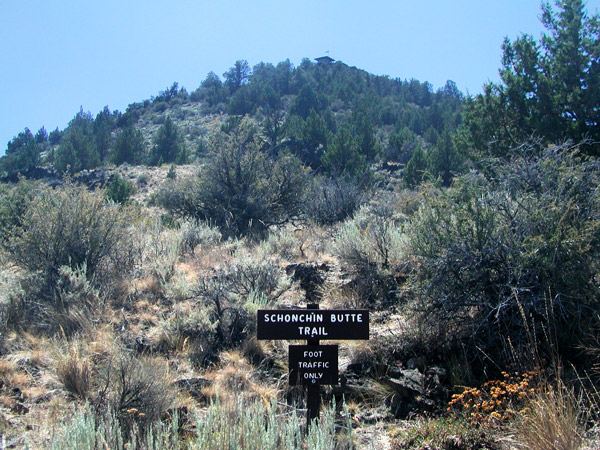
I asked
about storms in general and about lightning specifically, since he
was stationed on a high
point. He said they told him that in the event of a storm to sit on the stool, and he pointed out that each leg
of the stool was stuck in
a glass insulator of the type used on old-style power lines. The
bed was fitted likewise. I asked about the bed, and he said it
was in
case a storm forced him into an overnight stay.
I noted the heavy grounding cables running from the roof to the ground; he noted that they had recently discovered a few fire stations where the cables were incorrectly installed. His duty in the post was for 2 days each week. He didn’t like it. He said that he preferred to be on the ground, fighting fires. The post rarely received visitors. He told me, "Today is like Christmas." He had talked to a couple I had passed on their way down, plus me. I signed my name in the registry peak log: one of three entries for the day. The spotter recommended visiting Valentine’s Cave before exiting the park. |
My next stop was to the visitor’s center, which sat amidst a whole slew of lava tubes. I passed on those, figuring that Valentine's would be representative. |
Valentine's Cave was located at a turn off into a parking area a few miles away from the visitors center. There were only 2 or 3 other cars. I pulled out the small penlight I carried in my tank bag. Flashlights were available, but only at the visitors center. I wrongly assumed flashlights would be available at each cave. 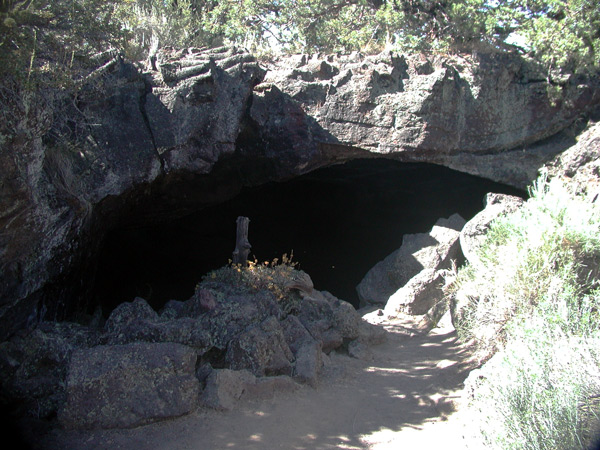 |
The penlight was inadequate. I could either light up the top of the cave to keep my head from knocking the ceiling, or I could light up the path for my feet to avoid tripping over rocks. I stumbled around on the uneven floor, and after following a group into the cave for a distance, turned back. 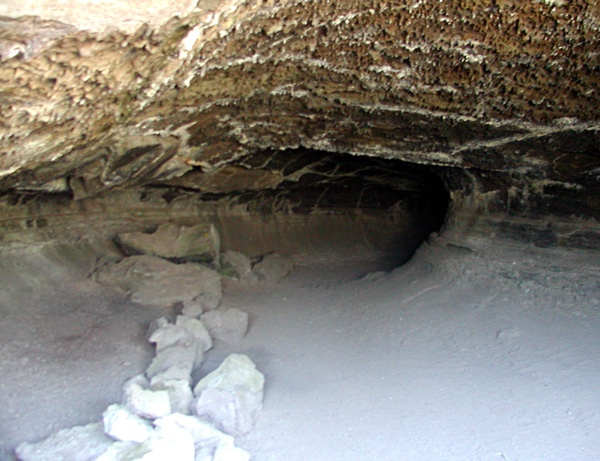 |
There were long moments of uneasiness as I stumbled around in the darkness, but after a few minutes, I saw light reflecting from the entrance to the cave. I took a few more pictures and climbed out. 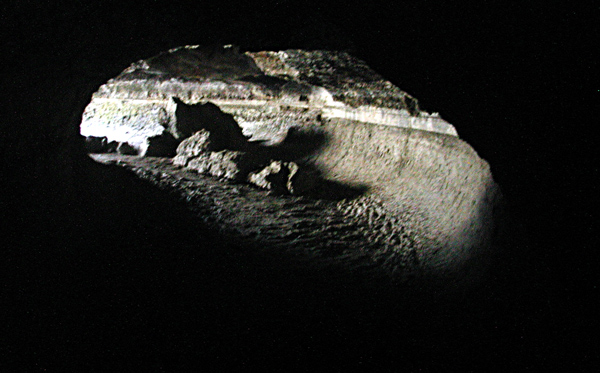 |
I drove out of the park and misread my turn. Lost, I reached a small town with a gas pump. They wanted a premium for each gallon of gasoline, much higher than the going rate. I declined to pump, so I bought cold drink instead and received directions on how to find my way back to a main road. The main road turned out to be the 39 – 229 to Fall River Mills, a town recommended for an overnight stay. I had an easy ride uphill into a forest and then a downgrade with views to a valley. At the bottom of the hill, a sign was posted that said “Construction – 10 miles”. It was the most jacked-up, disorganized botch I’d run into. The roadway was entirely gone, and what was left was an extended run of loose dirt, mud, and gravel. I was behind a semi. The semi could only go 5 mph, so at one point, I stopped so I could get enough distance to up my speed for stability. I ate a lot of dust. I no sooner cleared the first construction zone that I ran into a second flagger. Again, there was a long wait. The pilot car finally brought the opposing traffic by, turned around, and led us through. I couldn’t see why this section of road was shut down. Both of the original lanes were intact. At every repaving project I encountered earlier, one side of the road was removed and repaved, and then the other side. There was always one paved side to ride, except for short stretches on the Dawson and the Dempster. I guess California had to be different. Construction ended in the town of Fall River Mills. I took the second motel I saw. I was done for the day, and wanted to give the bike a chance to cool down. It had been in the high range (but not redlined) for 20 miles. I stopped at 7:30 PM. Reno was about 2 hours a way. My helmet visor was loosening, and I would try to make it to Reno tomorrow and have my wife meet me with the helmet's written instructions.
|


