7-20-04 Boise, Idaho to Missoula, Montana When I walked out to the bike in the morning, I met another of the riders who had stayed the night. Jonathon has a Honda Gold Wing and trailer, both purple. He and his wife were on the way to Las Vegas via Utah. He’s an LA electrical contractor. They had a nice bike and gear: in the trailer, he carried a laptop with a CD burner for digital photo downloading. I’m using smart cards. The clean clothes were repacked and the bike reloaded. I got a late (11:30 AM) start. The storms of the previous night were gone, leaving behind warm sunshine. I again rode the 55 north. Long, sweeping curves brought me once again alongside the Payette River. On the outskirts of Horseshoe Bend, I caught a glimpse of a sign for a sporting goods store. My immediate thought was the possibility that they carried a solution for the problem of my wet boots. I turned into what I thought was a driveway. Instead, the gravel path fell away from the road at a steep incline, and was blocked by a fence mid-slope. I almost dumped the bike trying to stay upright, and ended up with the front brake freezing the bike on the slope while I gingerly climbed off and walked the bike under power back up to the road. I drove back to the store. It was shuttered and for sale. Back on the road, I passed the site of the fallen tree. A crew was hacking it up into large chunks, and sawdust covered the pavement. Next up was the small town of Banks, an unsigned town at the intersection of an unlabeled road. I guessed from Jason’s directions and turned onto the road, which was eventually identified as the 21, or the Banks-Lowman Road. |
The road climbed up, following the river. Forest of pine thickened. I kept climbing until I got cold, and pulled off to put on the rain jacket. At some point, far below me, the Payette River curved away. 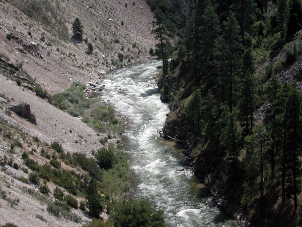 |
As I reached the high point and began a descent into the Sawtooths, I glimpsed a vista of sharp-edged mountains. I finally reached a pull off with one of the finest views I'd seen to date. In the foreground was an alpine meadow framed by a rustic pole fence. In the background, forests led away into the jagged summits of the Sawtooth range. 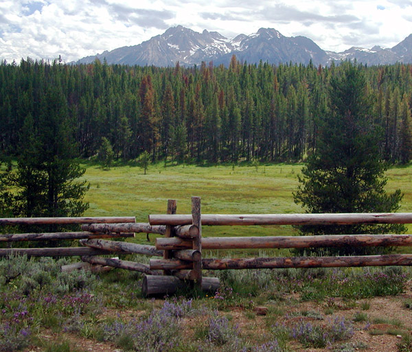 |
Back on the bike, I rode with the Sawtoothes to my right. At the small town of Stanley, I stopped to give my regards to Susie of Happy Trails’ aunt and uncle. Their retreat looked directly at the same vista I had photographed and admired earlier. Suzie’s aunt asked if I was turning south to go to Sun Valley. She said the north was “deserty”. Desert was OK by me. |
21 junctioned at the 75. I turned northeast and began a descent along the Salmon River. As I descended, the terrain changed from Alpine to desert. The contrast between the Salmon River green belt and the arid mountains looked much like the land surrounding the Colorado River. 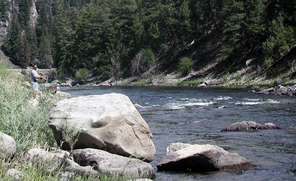 |
I kept my speed reasonable to enjoy the view. Traffic was light. The road followed the Salmon River through narrow gorges cut by the river’s action. I was riding with my feet on the highway pegs, leaned back against the Wolfman Alpha, and my head tilted up looking at the cliffs above me when something hit my neck and stung like hell. With my gloves, I lightly brushed my neck, which intensified the pain. I finally pulled off the road and flicked the stinger out of my neck. A bee had suicided butt-first into me. The pain caused a few involuntary shivers, then subsided to an irritating itch. Shortly before the 75 met the 93 at Challis, there was a historical site tagged as a “Buffalo Jump”, where the Native Americans of the region hunted buffalo by driving them to their deaths over the edge of a cliff. |
I pulled into a turnoff and took a few pictures. It was sweltering: no breeze and under direct midday sunlight. As I was admiring the view, an antique fire truck cruised slowly past me, and the crew waved. 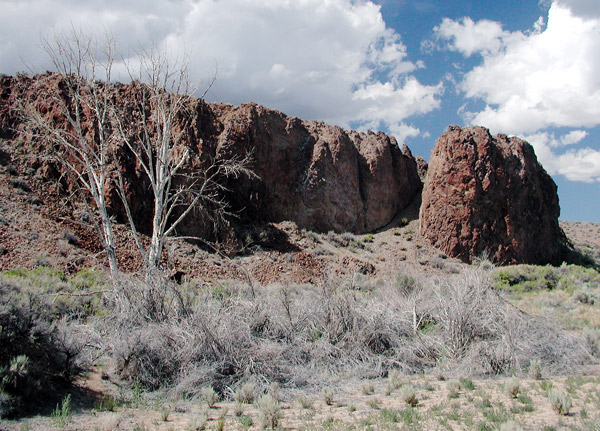 |
The 73 hit the 93 shortly thereafter. I’d no sooner turned north than a wind began knocking me from left to right. Ahead of me, a stream of what looked like white dust blew across the road. The stream was dense, and appeared to be about 50 feet high. When I entered its boundary, the stream turned out to be made up of a band of heavy rain blown horizontally across the road. I was in the stream for about a quarter mile, until the rain ended as suddenly as it began. I was back in sunshine and blue skies, but ahead of me was another stream, looking almost identical to the first. I stopped between the two streams. I turned around and once again penetrated wind and rain. Dampened, I drove back to the town of Challis for a late (4:30 PM) lunch. The food tasted good – a grilled ham sandwich, my first meal of the day. When I returned to the road, the bands of rain were gone. I don’t know where the rain originated from. There were clouds floating overhead, but they appeared more like fair weather cumulus than nimbus. One cloud streamed virga as it departed to the east. It may have been the source. I crossed the 45th parallel and the road began shadowing the course of the Bitterroot River. This was a day of rivers: the Payette, the Salmon, and now the Bitterroot. Near North Fork, something small and furry in the middle of the road darted left, right, then spun directly below me in a circle. I don’t know what it was and I don’t know if I hit it. A short distance later as I was slowing down to read a historical marker, a doe and two fawns stepped into the middle of the roadway. As I approached the deer, I pulled in the clutch and coasted towards them. They bolted into the forest. I stopped at Deep Creek, a Lewis and Clark historical site, to put on the rain jacket for warmth. The Idaho section of the 93 compared to Nevada's 93 was a twisting pleasure. |
The road finally flattened out as I crossed into Montana. Taking advantage of the long dusk, I stayed on the road until I reached Missoula, Montana. Today was the first day that I really noticed longer days resulting from traveling north.  I was surprised to find when I stopped that it was close to 10:30 PM. |
|


