| 7-28-04 Dawson the Yukon Territory, to Eagle Plains, the Yukon Territory, to Inuvik, in the Northwest Territories - a possible error in judgment, - 460 miles one way, of which - the first 239 miles were without services, - and a long, long, day! When I woke up, I found out that the shower was faulty. It dribbled with barely enough volume to get me wet. The night before, I discovered that the TV was faulty. The lodge's power lines had been hit by lightning about a week earlier, frying a number of electronic devices. Thank goodness the coffeemaker in the restaurant still worked. I checked my tires. Both were down about 2 pounds per square inch, cold. There were clouds to the west; it was clear to the north. I filled my tank one final time, and squeezed the gasoline right to the top of the filler neck, holding the bike upright off the side stand. Still balancing the bike upright, I started the engine and rolled out of the Klondike Lodge parking lot and over the wood-surfaced bridge marking the start of the Dempster Highway. For the first few miles I was very aware of rocks sticking up in the roadway, and tried to dodge each stone as it came up. It didn't work: I could not react fast enough. I lifted my frame of reference up to about 100 feet ahead of the bike, with better success. Finally, I just gave up and hoped the tires would live up to their expensive reputation. My speed settled in to about 45 miles per hour. |
Not many miles down the road, I stopped at the Dempster Interpretive Center to check on road conditions and for a brief self-evaluation. 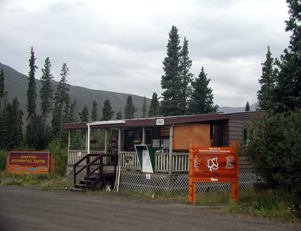 The Center's manager told me that bears had been active in the area. As far as she knew, the conditions on the Dempster were nominal and the road was open to at least Eagle Plains. I thanked her and resumed my journey. |
The first mountains I hit were the Olgilvies, leading to an early crest of the highest point on the highway. On the way to the crest, it began to drizzle. There was a slight patina of mud on the roadway. The Dempster is two lanes wide, but because of the lack of traffic, drivers tend to steer towards the middle of the road. Three distinct tire tracks are created, with one riding right down the center of the roadway. I found that in light to moderate rain, the best strategy was to stay on the high side of the road in the highest track The rainwater would trickle into the lower tracks, leaving the high track relatively drier and less muddy. There were no worries about getting caught on the wrong side of the road by oncoming traffic. There wasn't any traffic. 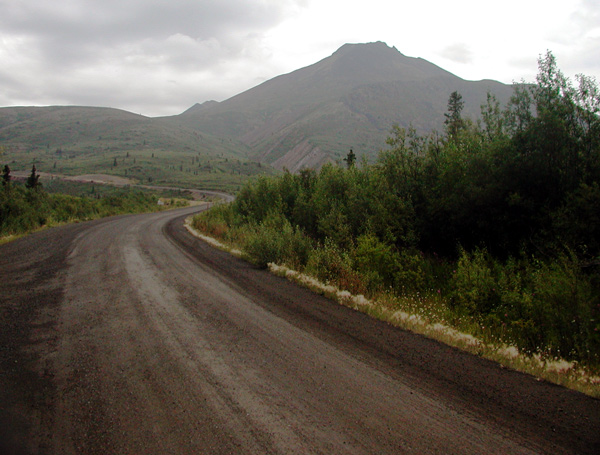 Shortly thereafter, I saw my first tundra. It felt soft and spongy underfoot. |
The rain lessened and eventually stopped. After passing the jagged prominence of Tombstone Mountain, the Olgilvie Mountains became smooth-surfaced, rounded and barren. They are old mountains, untouched by glaciation. 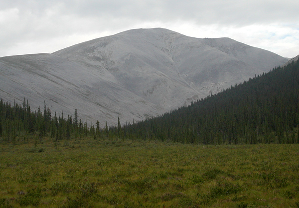 |
I took a break alongside Red Creek. The creek is a riot of colors, the water stained yellow by sulfur-laden springs and the rocks stained red from deposits of iron. 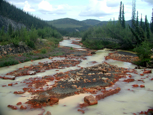 |
The skies continued to clear. 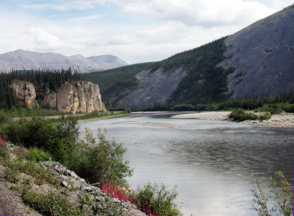 |
I left the round mountains behind, dropped down to the Olgilvie River and began to climb again. Ahead of me were a series of dark clouds, disconcerting to look at because they seemed to be boiling and descending towards me. I realized I was moving in the same direction as they were, overtaking and rising to meet them. 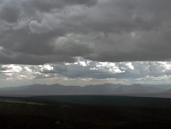 |
As I climbed, it began to rain. I wanted to pull to the side to put on my rain gear, and I almost made a bad mistake. The downside shoulder of the road was composed of loose, mushy gravel, and as soon as the bike left its lane, it went into an immediate wobble towards a ditch. I timed pushes to the left handle bar with the oscillations. Wobble left, push bar, apply power. My curve towards the ditch flattened, straightened, and finally began a return towards the center of the roadway. The bike jumped back onto the harder surface, but was still unstable. I finally found a good edge and stopped to pull on my rain boots. I passed through a couple of more showers, and the skies again began to clear. The landscape changed to rolling forests of miniature trees. 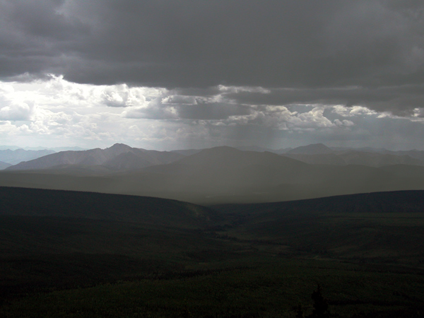 Eagle Plains finally appeared in the distance. I stopped for lunch and fuel. My mileage worked out to 50-plus miles per gallon. That had to be the result of the slow pace I was maintaining. I considered stopping for the night at Eagle Plains, but the combination of clearing weather and abundant sunlight convinced me to keep going. Throughout the day, I had been meeting up with and talking to a couple in a Dodge pickup with a cap on the back. They carried a mattress in the bed of their pickup, along with camping gear. I could maintain a slightly higher speed on the bike, so I would pass them. Since I stopped frequently to take pictures, they would pass me. We left for the Arctic Circle about the same time. |
It was a short run to the Arctic Circle. I arrived first. I parked the bike in front of the sign designating the demarcation of 24-hour sunlight on the longest day of the year. There was a flat quality to the sunshine. Like during a partial solar eclipse, the light washed out over the land with a subdued intensity. Except for the rustling of a light breeze, there was silence and a feeling of incredible emptiness. 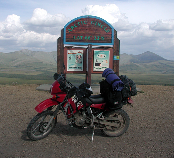 Reaching the Arctic Circle had been a dream of mine since the first time I had read as a child of the existence of lands where the sun never set. I walked around the gravel pad, relishing the feeling of accomplishment and soaking up the panorama around me. |
While I was enjoying the view, a couple drove into the parking lot and stepped out of their car. I approached one of them and asked if he would mind taking my picture. He said, "No problem." I then asked, "Would you mind taking a photo that some people may consider offensive?" He said, “As long as you don’t show me your ass, eh?” and laughed nervously. I laughed. "I'm not going to show you my ass." He aimed the camera, and I said, "This shot is for my friends and for all of the people who offered me encouragement to make this trip...." 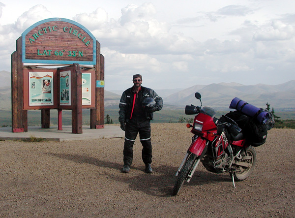 |
... and this shot is for my enemies, and for all of the people who told me I was crazy to try it! 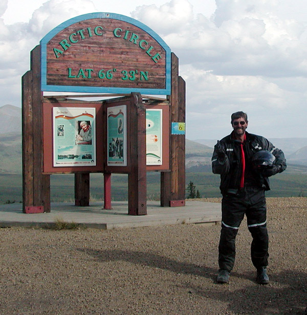 The Dodge couple rolled into the parking lot as we were taking pictures. They walked up as the "enemies" picture was being taken. I was worried that they would be offended. They were not; they thought it was funny. We all traded cameras and took the photographs needed to document our presence at the Circle. For the Dodge couple, the Dempster Highway represented "a trip of a lifetime", and the culmination of a long period of planning and saving. When they were in Dawson, they were told that the Dempster was closed at Fort McPherson due to fires. They left anyway, and at Eagle Plains, first learned that road was open. I was completely unaware that there had been closures. I left before them and continued north. |
I could see a bank of clouds begin to coalesce ahead as I approached the Northwest Territories border. 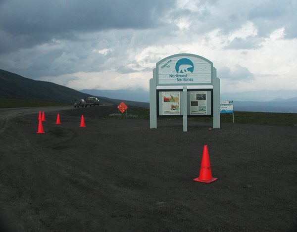 |
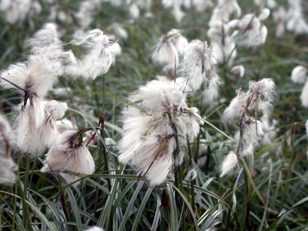
At the border, the landscape was covered with green and white: the green from grasses coving the slopes of the mountains and the white from cottony flowers. 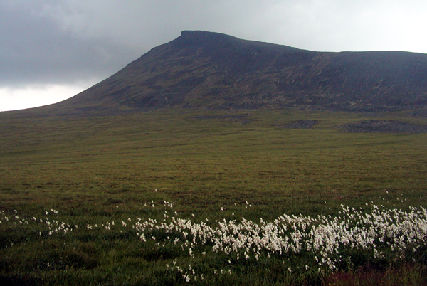 |
 |
From the NWT border, the road began climbing into the Richardson Mountains. I ran into a first splattering of rain and ascended into clouds. As soon as I entered the clouds, my visor fogged up. I flipped up the visor, and my glasses immediately fogged up. I lost all forward visibility. The only thing I could see by looking at my feet was the surface of the road passing under the pegs. I was still in a tire track. Hoping the road wouldn't curve, I braked to a straight-line stop and tried to clear the visor, but the fog was both inside and outside my helmet. I lifted the visor and cleared my glasses. They immediately fogged again. I finally pulled my glasses down to the end of my nose. Tilting my head into the quartering wind with the visor partially lifted blew the rain away from my eyes and gave me a narrow slit of vision between the bottom of the visor and the top of my glasses. It began to sleet, and the left side of my face stung from the impact of the ice crystals. My speed dropped drastically. 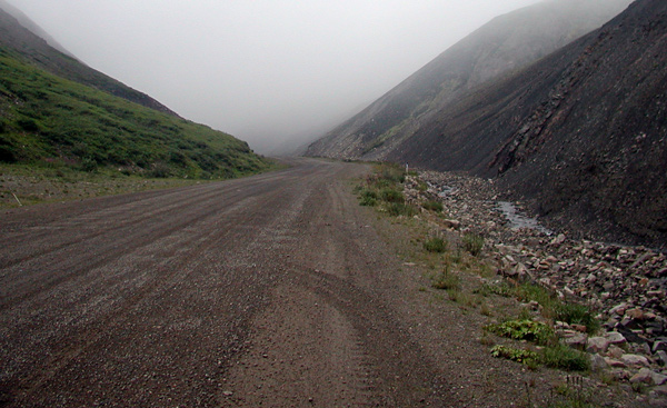 Next up was fresh gravel, really nasty shit composed of marbles 1 - 3 inches in size. Any slight deviation off my line and out of the car tire tracks resulted in a wobble. The loose gravel was mounded on either side of the tracks. The road crested, smoothed out, leveled off, and finally descended. Ahead were lighter skies. The rain abated, but was still falling. The road finally dropped below cloud level onto a broad, flat shelf of land. It wound in a twisting route over the surface of the shelf before beginning a descent to the tundra below. |
I finally reached Fort McPherson and the Peel River ferry. I stopped in town for gasoline and met up once more with the couple in the Dodge. They said that they had worried about me and had checked the side of the road to make sure I hadn't crashed. I thanked them profusely for their concern. 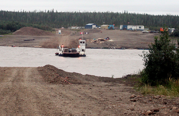 |
 The gas station and hotel at Fort McPherson was run by a Native American Co-Operative. The counter of the gas station was run by an angry old woman. The only response she would mutter to any of my questions was "No room." No amount of my charm or good looks seemed to help. "Do you have any rooms for the night?" "No room!" "Is there anything up the road?" "No room!" .... "Are you a witch?" "No room!" "Thanks." |
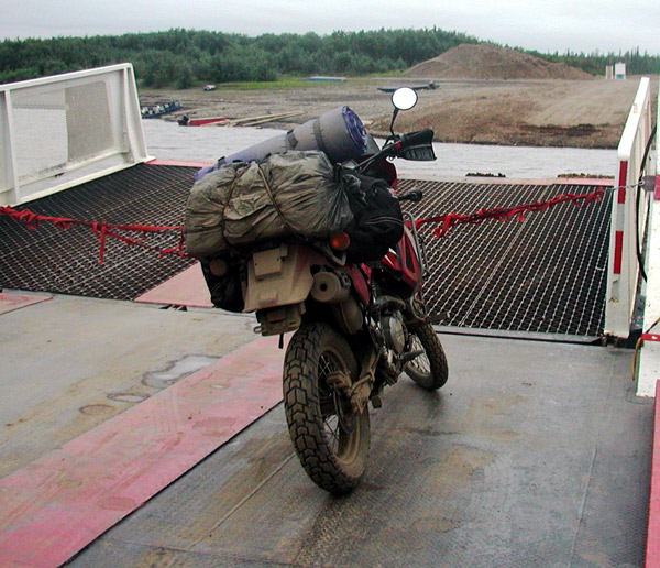
I pushed on to the confluence of the Arctic Red and MacKenzie Rivers, and the MacKenzie Ferry. The ferry has two destinations from the south side of the Dempster: across the MacKenzie to the northern continuation of the Dempster, or across the Arctic Red River to the community of Tsiigehtchic. 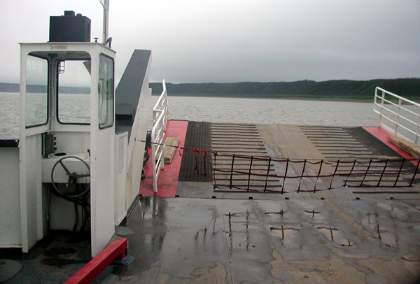 |
One of the ferry crewman said that there was a possibility of a vacant room in Tsiigehtchic. 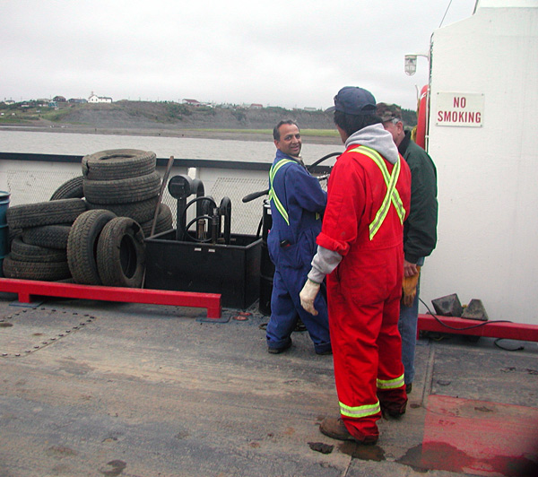 |
Midnight, Tsiigehtchic I drove up to the building indicated by the crewman, and knocked on the door. The last room had been rented one half hour earlier, and the occupant of the room, a goofy-looking bicyclist, stuck his head out of the door long enough to tell me so and then shut the door in my face. 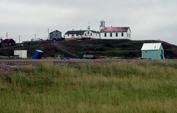 |
| So nowhere to go but on to Inuvik. I waited for ferry in Tsiigehtchic. The ferry left the south Dempster landing, picked me up, and headed back to the south Dempster. We picked up a local, and then went back to Tsiigehtchic. I finally made it to the North Dempster shore, after midnight and with at least 2 hours left to drive. It was still raining. The land flattened out into endless tundra. The sky faded into monochromatic stratus, and the whole scene stayed locked in a perpetual state between dusk and darkness. I could see a mass of dark clouds laying low to the north. I rode hunched grimly over the handlebars, monotonously flicking the raindrops off my visor. It was cold. Raining. After 2 hours of misery, the road switched from gravel to paved. About 20 miles later, there was a glow to the north, which resolved itself into an airbase on the outskirts of Inuvik. I rode onto the empty main street of Inuvik shortly after 2 AM. It was still light. I booked a room at the MacKenzie Hotel and paid a stiff premium for the privilege of staying in an old, stuffy room overlooking the parking lot. After leaving a request for a same-day wakeup call at 10:30 AM, I popped a beer and turned on the Canadian weather channel. A Pacific Maritime low was approaching from the west. An Arctic low was approaching from the north. Winter was coming to Inuvik. |
   |
 |