|
7-14-04 Ramona, California to Laughlin, Nevada Departure day: hot and humid. Thunderstorms were firing off to the east. A plume of subtropical moisture streamed north from Mexico and over the heat of the desert, sending towers of cumulus shooting into the atmosphere. Fringes of the storms drifted over the mountains and into the inland valleys.. Most of the morning was spent checking over the bike and loading gear. After kissing the wife and kids goodbye, I mounted the bike around midday and coasted down the driveway. At the end of the driveway, I rolled on the throttle and turned left onto Old Julian Highway, gingerly checking the amount of lean against the increased weight of the gear. The bike felt stable: a little heavy, but manageable. The highway soon joined California Highway 78 and climbed gradually east towards the mountains. Around Santa Ysabel, a brief drizzle dampened the roadway. Low clouds drifted overhead. I heard occasional rumbles of thunder in the distance. A left turned me northward onto California Highway 79, following the western shoulders of the mountains. Just past the Warner Springs glider port, the skies opened up with a drenching downpour. The heavy raindrops instantly penetrated my mesh jacket and saturated my t-shirt. I raised my visor to breath in the rain's aroma: the smell of water in the desert has an enervating, exciting effect. The smell turned acrid as I passed a fire battalion cleaning up the remains of an earlier wildfire. A short time later, the rain ended and the road began a slow climb to 7000 feet into the San Bernardino Mountains. With elevation, the air turned colder, enough to set my teeth chattering. The t-shirt was still damp; moving through the air wicked away moisture and enhanced the cold. The road finally crested the mountains and began a twisting descent eastward into the heat of the desert. The dry, 90-degree air quickly evaporated the moisture of the earlier rains and warmed me back up. Interstate 10 provided a quick run to the Twenty Nine Palms exit, where I again turned north. I gassed up in Twenty Nine Palms and turned easterly on Amboy Road. There were numerous shacks scattered through the area. The shacks were raised by homesteaders, and were mostly uniform in size, about the dimensions of a single-car garage. They were built to the minimum dimensions required to hold the land. Some were occupied; most were not. The road took a sharp left turn and climbed to Sheep Hole Pass, and then began a long, gradual descent towards the small town of Amboy, entering the Mojave National Preserve. The preserve encloses a landscape formed by a mix of violent volcanic events, uplift, and erosion. Normally, summertime in the Mojave is unbearably hot. That day was a rare event: the upper atmosphere was hazed by the rise and decay of the numerous storms in the area. Water vapor and ragged fragments of cloud tinged the sky a metallic gray. The heat was diffused by the motion of the bike through the air and by filtered sunshine. The engine, running at a steady 4000 RPM at 60 miles per hour, breathed easily. The extra weight on the bike smoothed out the rough pavement on which I travelled. In the clarity of the desert air, objects near the horizon seemed to remain almost stationary. There was an eerie sensation of floating in place over the terrain. The road was empty. Amboy Road crossed over the crusted salts of an ancient lake bed and then skirted the black lava field of the Amboy Crater. Amboy Crater was formed fairly recently around 6000 years ago. Its cinder cone provides a distinctive landmark just off Old Route 66, marking the intersection of 66 with Amboy Road. A right on Old 66 turned me back to the east.
|
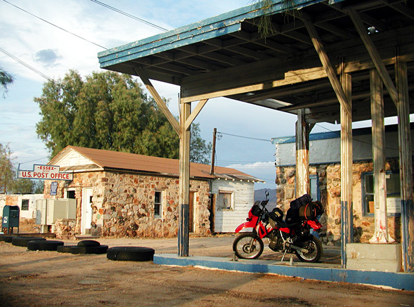
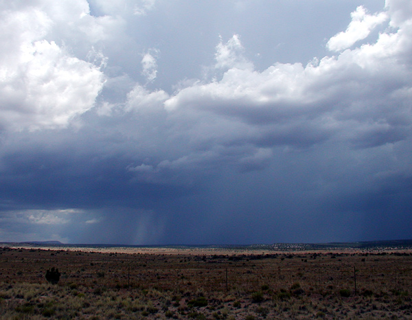
At the town of Essex, a shaft of heavy rain straddled the road. It was narrow and sharply defined. I coasted to within 15 feet, close enough to hear the hissing of the rain hitting the pavement. Mist drifted over me and speckled my visor. I could see sheets of water layering the road. It was inching away, following the road to the east, so I decided to shelter the bike under the eave of an abandoned gas station until the storm moved off.  |
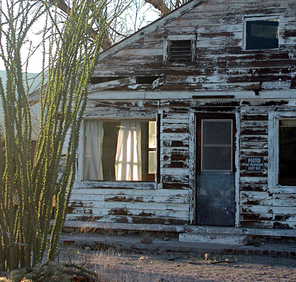
I dismounted and walked out to the center of the roadway to look around. Across the road sat an empty house, its original white exterior scarred and peeling. Holes gaped where boards had pulled away. Strangely, the windows were unbroken, and the tattered remains of curtains still hung in the casements. To the south was a shop littered with piles of old tires. To the north and immediately adjacent to the gas station was a small stone building housing the Essex post office. The building was locked and empty, but there were three banks of PO mailboxes mounted on the exterior.  It was quiet. The only sounds heard were from the light winds and the rain. If there was anyone nearby, they remained unseen. I walked back to the bike and slouched against a column, trying to remain inconspicuous. I did not want to meet any of the residents who chose to remain as the desert slowly reclaimed the land. Essex was decaying into a ghost town. |
After 15 minutes or so, the rain reached a curve and departed the road heading southeast.  I swung back on the bike and moved over pavement rapidly drying in the low desert humidity. By now, the sun was nearing the horizon, and the quality of the air had a golden cast. It was noticeably cooler. |
|
As the 66 passed under the I-40 interchange, the road turned to gravel. There was a sign posted, “End of County Maintained Road”. Although my map showed the road continuing on to connect with U.S. Route 95, its surface appeared rutted and washed out. The approaching darkness made my decision for me, and I returned to the interchange and entered I- 40 east. A short distance later, 95 crossed the freeway heading north. There was a brief consideration of stopping for gas at Needles, but I did not want to drive the extra miles from 95 to Needles and back. 95 was two-lane pavement, fairly straight, but undulating with mounds and dips. It is a major Nevadan north-south route, and there was a constant rumble of semis traveling in both directions. I passed the slower trucks on the straights until my mileage indicated that fuel was becoming a concern, while my destination, Laughlin, was still nowhere in sight. The only mileage signs referenced the town of Searchlight, far north of my destination and well out of range. I backed off the throttle to conserve fuel. It was dark now, and I was passing through country with very few residences and very few lights. I wondered if I was on the right road. I was relying on the memory of an earlier trip, and I hadn’t checked the map. I wasn’t even sure where I was. I concentrated on driving the narrow cone of light thrown out by the headlight of the bike and tried to ignore the blackness closing in around me. For the second time that day, there was a feeling of disembodiment; of floating. Unlike earlier, there were no fixed points of reference, just the glare of approaching headlights and the red taillights of vehicles ahead of me rising and falling with the road. As the road crossed the Nevada state line, a glow appeared on the horizon to the right. A signed turnoff brought me to a well-maintained four-lane road and, finally, to a sign pointing to Laughlin.
A few miles later, the road crested a ridge, and
the lights of Laughlin spread out along the
Colorado River below me. Cresting the ridge also turned
on a blast furnace as I descended into the desert
heat I had avoided all day. I turned on to the main street
paralleling the river, nervously monitoring the
rising temperature gauge. A few slow miles and a
few stoplights later, I finally entered the
parking structure of the Flamingo Hilton hotel
and casino. There was
an empty parking space next to the
entrance. I rolled
the bike into the parking spot and shut off the
engine. In the sudden
silence and soaked in sweat, I shouldered the
Alpha luggage bag and the duffel, and
walked into the cool air of the
casino.
|


